
Extract GPS locations from photos on Mac
Pull the locations out of many photos at once, with map links, and export CSV, GPX or KML.
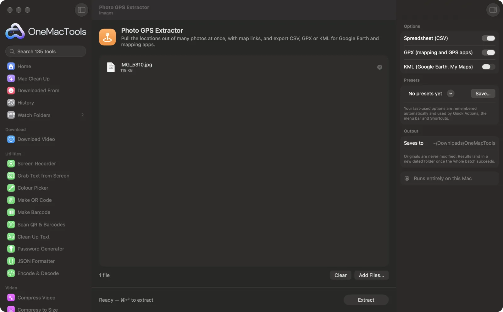
Photo GPS Extractor on a Mac
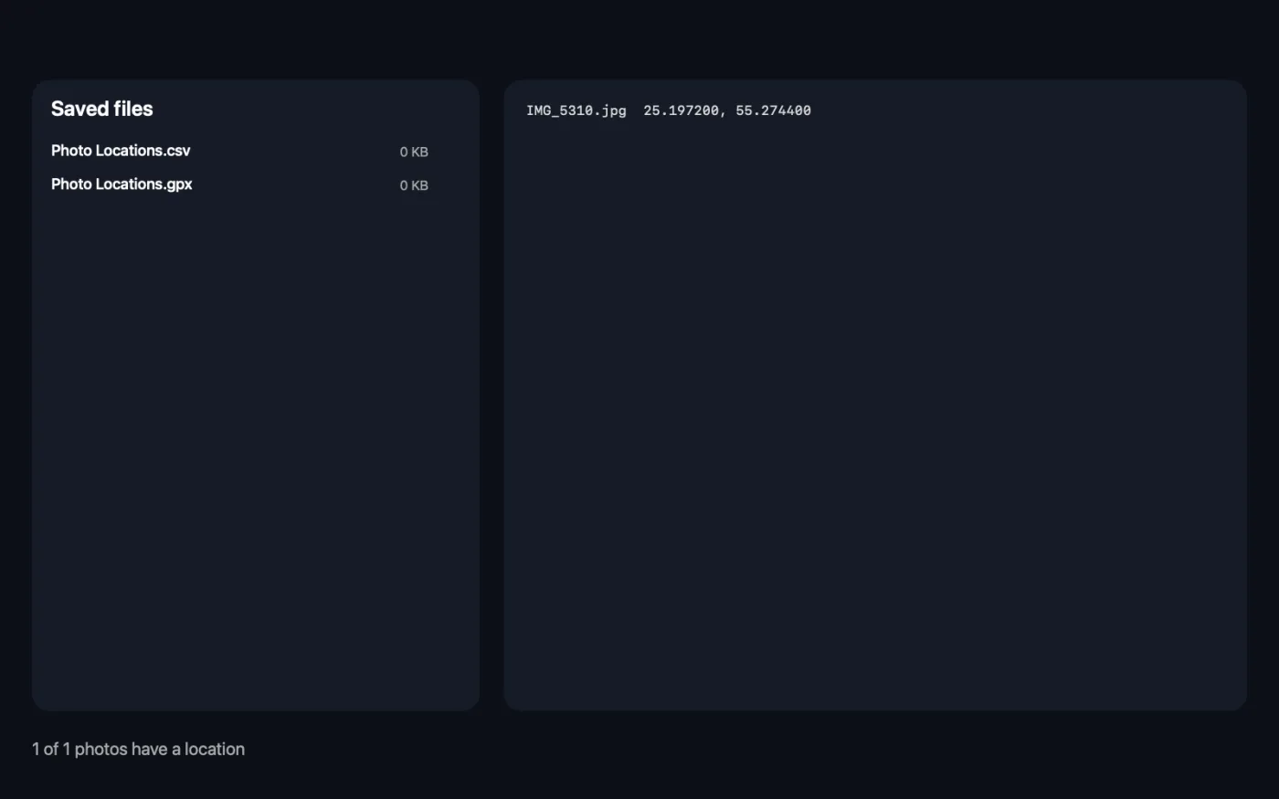
Screenshots from the app, using sample files.
How to use Photo GPS Extractor
- 1
Drop your photos
Add a handful of photos or a whole trip's worth. Photos without a location are fine; they're listed so you know they were checked.
- 2
Choose the exports
Turn on a CSV spreadsheet, a GPX file, a KML file, or any combination.
- 3
Click Extract
Every location is read on your Mac, and the app shows each photo's coordinates when it's done.
- 4
Use the files
The exports are saved as “Photo Locations” in a dated folder in Downloads › OneMacTools. Open the CSV in Numbers or Excel, or the GPX or KML in a mapping app or Google Earth.
What Photo GPS Extractor does
Drop a folder of photos and get every location in one go: a spreadsheet with coordinates, time and Apple Maps and Google Maps links, a GPX file for mapping and GPS apps, and a KML file for Google Earth and My Maps. Photos without location data are listed too, so you know what was checked.
Great for
- Map where a trip's photos were taken
- Check photos for location before posting
- Organise site-visit photos by place
Options explained
- Spreadsheet (CSV)
- On by default. One row per photo with latitude, longitude, altitude, date taken, and Apple Maps and Google Maps links. Photos without a location are included and marked “No GPS data”.
- GPX (mapping and GPS apps)
- On by default. A waypoint for each located photo, named after the file, for mapping apps, GPS devices and route planners.
- KML (Google Earth, My Maps)
- Off by default. A placemark for each located photo, for Google Earth and Google My Maps.
Best practices
- Use the CSV to sort or filter photos by place, then click the map links to check a spot quickly.
- Import the KML into Google My Maps to see a whole trip as pins on one map you can share.
- Run it on photos before you post or sell something online. If a photo of your home shows a location, remove it with Remove Metadata first.
- If none of your photos have a location, check Location Services for the Camera app on your phone; screenshots and photos received through messaging apps usually have none.
Works with
- In
- JPEG, HEIC, PNG, TIFF and other images your Mac can open, usually straight from a phone or camera.
- Out
- Photo Locations.csv, .gpx and .kml, depending on the options you turn on, plus a list of coordinates shown in the app.
- If none of the photos have location data, nothing is saved and the app tells you why.
- Map links in the CSV open in your browser; reading the photos never goes online.
Questions about Photo GPS Extractor
How do I get the GPS coordinates from a photo?
Drop the photo onto Photo GPS Extractor and click Extract. The app lists the latitude and longitude, and the CSV adds the altitude, date and map links.
Can I put my photos on a map?
Yes. Turn on KML and import the file into Google Earth or Google My Maps, or use the GPX file in a mapping or GPS app. Each photo becomes a pin named after the file.
Why do some photos say “No GPS data”?
They don't contain a location. Screenshots never do, photos sent through messaging apps usually have it stripped, and phones only record it when location access is on for the camera.
Can I extract locations from hundreds of photos at once?
Yes. Drop a whole folder's worth; every photo gets a row in the spreadsheet and every located photo becomes a waypoint.
What is the difference between GPX and KML?
Both store map points. GPX is the common format for GPS devices and outdoor mapping apps; KML is the format Google Earth and My Maps use.
Does Photo GPS Extractor upload my files?
No. Photo GPS Extractor runs entirely on your Mac, so your files never leave it and it works offline.
Will Photo GPS Extractor change my original files?
No. Results are saved as new files in a dated folder in Downloads › OneMacTools, and your originals are left exactly as they were unless you turn on an option that says otherwise.
What does Photo GPS Extractor need?
Just a Mac with macOS 26 or later. There's nothing else to install.
Do this next
Strip location, camera and other EXIF data before sharing.
Image Info & EXIF ViewerSee size, dimensions, format and DPI, plus the camera, date and location hidden in a photo.
Related Images tools
Convert between PNG, JPEG, HEIC, AVIF and TIFF. Reads WebP, RAW and more.
Compress ImagesShrink photos for email and the web, with a live before-and-after preview.
Convert to WebPMake small, web-ready WebP images, lossy or lossless, with transparency kept.
Resize ImagesResize by longest edge, exact pixels, percentage, or print size in cm, mm or inches at the DPI you need.
Crop ImagesCrop to an aspect ratio or an exact area, or trim plain borders automatically — one photo or a whole folder.
Rotate & Flip ImagesTurn or mirror photos in one go.

Photo GPS Extractor, plus 134 more.
One app. One price.
All 135 tools for $29, once. 14-day money-back guarantee.